


Alabama Voting District, Nevada County, Arkansas
About
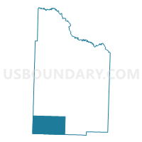
Outline

Summary
| Unique Area Identifier | 527430 |
| Name | Alabama Voting District |
| County | Nevada County |
| State | Arkansas |
| Area (square miles) | 45.62 |
| Land Area (square miles) | 45.51 |
| Water Area (square miles) | 0.11 |
| % of Land Area | 99.76 |
| % of Water Area | 0.24 |
| Latitude of the Internal Point | 33.48783940 |
| Longtitude of the Internal Point | -93.39792450 |
Maps


Graphs
Select a template below for downloading or customizing gragh for Alabama Voting District, Nevada County, Arkansas


Neighbors
Neighoring Voting District (by Name) Neighboring Voting District on the Map
- Bodcaw Rural Voting District, Nevada County, AR
- Bodcaw Voting District, Hempstead County, AR
- Center Voting District, Lafayette County, AR
- Sardis Voting District, Lafayette County, AR
- Waldo TWP Voting District, Columbia County, AR
- Willisville Rural Voting District, Nevada County, AR
Top 10 Neighboring County Subdivision (by Population) Neighboring County Subdivision on the Map
- Waldo township, Columbia County, AR (2,369)
- Baker township, Lafayette County, AR (1,975)
- Hadley township, Lafayette County, AR (1,027)
- Parker township, Nevada County, AR (628)
- Taylor township, Nevada County, AR (524)
- Bodcaw township, Hempstead County, AR (511)
- Alabama township, Nevada County, AR (279)
Top 10 Neighboring Unified School District (by Population) Neighboring Unified School District on the Map
- Hope School District, AR (15,849)
- Lafayette County School District, AR (5,731)
- Nevada School District, AR (2,928)
- Waldo School District, AR (2,369)
Top 10 Neighboring State Legislative District Lower Chamber (by Population) Neighboring State Legislative District Lower Chamber on the Map
- State House District 3, AR (25,835)
- State House District 4, AR (25,193)
- State House District 5, AR (22,892)
Top 10 Neighboring State Legislative District Upper Chamber (by Population) Neighboring State Legislative District Upper Chamber on the Map
Top 10 Neighboring 111th Congressional District (by Population) Neighboring 111th Congressional District on the Map
Top 10 Neighboring Census Tract (by Population) Neighboring Census Tract on the Map
- Census Tract 9502, Columbia County, AR (4,801)
- Census Tract 4701, Lafayette County, AR (4,728)
- Census Tract 4804, Hempstead County, AR (3,972)
- Census Tract 903, Nevada County, AR (1,544)
Top 10 Neighboring 5-Digit ZIP Code Tabulation Area (by Population) Neighboring 5-Digit ZIP Code Tabulation Area on the Map
- 71801, AR (16,745)
- 71770, AR (3,526)
- 71860, AR (2,633)
- 71858, AR (1,710)
- 71835, AR (1,334)
- 71827, AR (817)